

Blue Heron Beach Dive Site Map
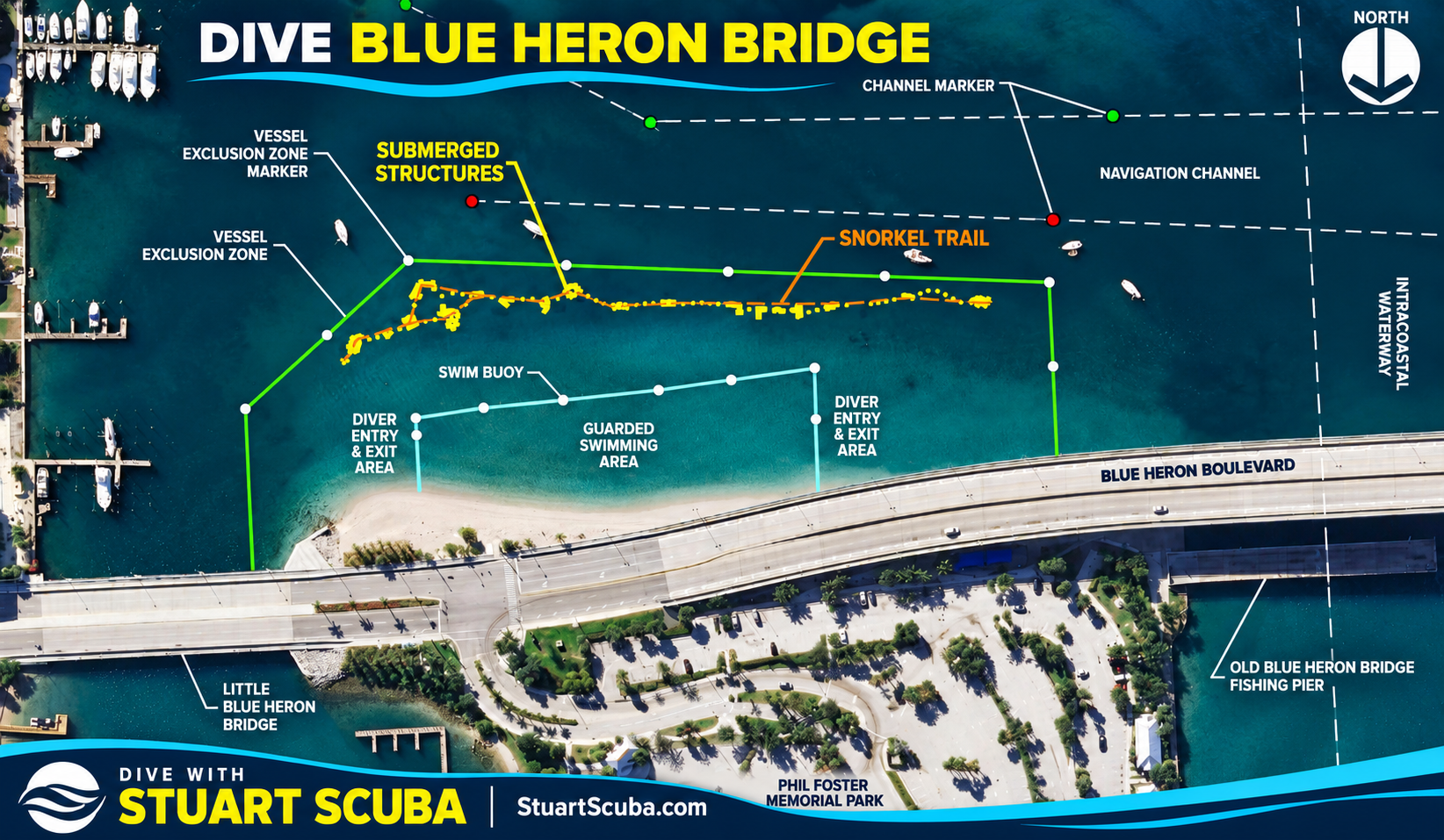
What the map identifies
- Swim area: the guarded swimming area and swim buoy are separate from the dive area.
- Snorkel trail and structures: the trail and submerged features are shown as orientation points.
- Diver entry and exit areas: use current on-site directions to choose an appropriate route.
- Vessel boundaries: remain outside marked vessel exclusion zones and clear of navigation channels.
- Landmarks: Blue Heron Boulevard, the Little Blue Heron Bridge, the old fishing pier and Phil Foster Memorial Park help you orient yourself.
Important: currents and tide change the plan
Palm Beach County's site map includes a strong-current warning and identifies different entry and exit areas for incoming and outgoing tides. This simplified Stuart Scuba graphic does not show those tide-specific directions. Do not use it alone to select an entry point. Check the current county map and park signs, assess conditions with your buddy, and stay within your training and comfort.
Use the zones respectfully
Scuba diving is permitted outside the guarded swimming area during the park's permitted hours. Do not enter the guarded swim zone or the marked navigation channel. Keep clear of vessels, anglers and fishing gear, and follow posted instructions if boundaries or access have changed.
Back to the Dive Blue Heron Bridge guide | Blue Heron Bridge Scuba Diving overview


